
HOUSTON CONSTRUCTION DRONE SERVICES
Aerial progress documentation for job sites across Cypress, Katy & the Greater Houston area
Progress,
You Can Prove.
Consistent aerial documentation that helps your teams track progress, prevent costly mistakes, and communicate confidently with stakeholders.
Progress Tracking
✳︎
Monthly Retainers
✳︎
FPV Milestone Video
✳︎
Site Documentation
✳︎
Stakeholder Reporting
✳︎
Progress Tracking ✳︎ Monthly Retainers ✳︎ FPV Milestone Video ✳︎ Site Documentation ✳︎ Stakeholder Reporting ✳︎
Why Aerial Documentation Matters
Ground-level photos only show what’s directly in front of the camera. A drone gives your team a consistent, repeatable vantage point that a phone or ladder can’t match. The same angle, the same coverage, every time a flight happens.
That consistency is what makes aerial documentation useful beyond a single nice photo. When every flight follows the same path, you can compare one week to the next and see real progress, not just a snapshot.
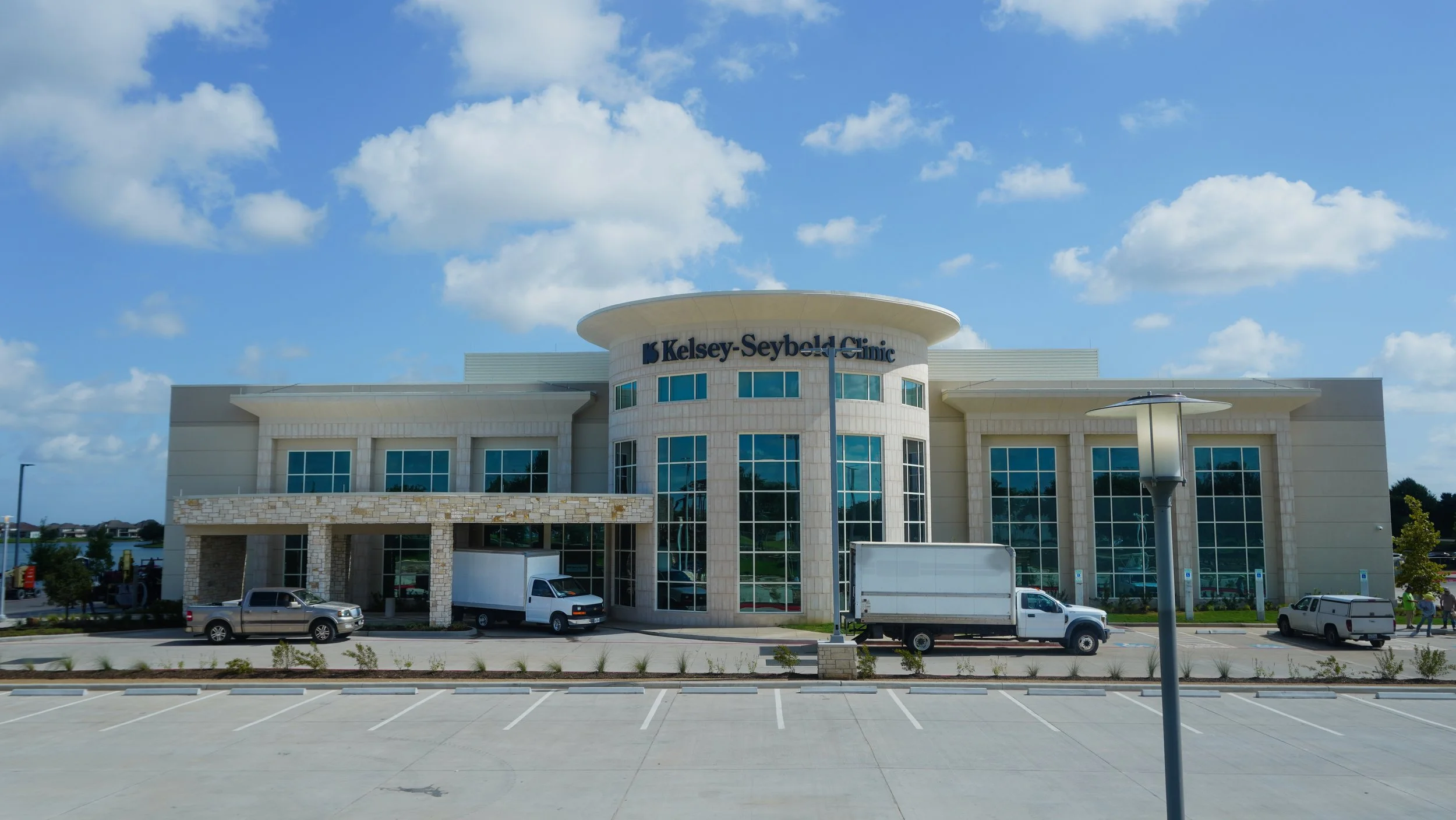
Ground View
A great visual of what’s directly in front of you.
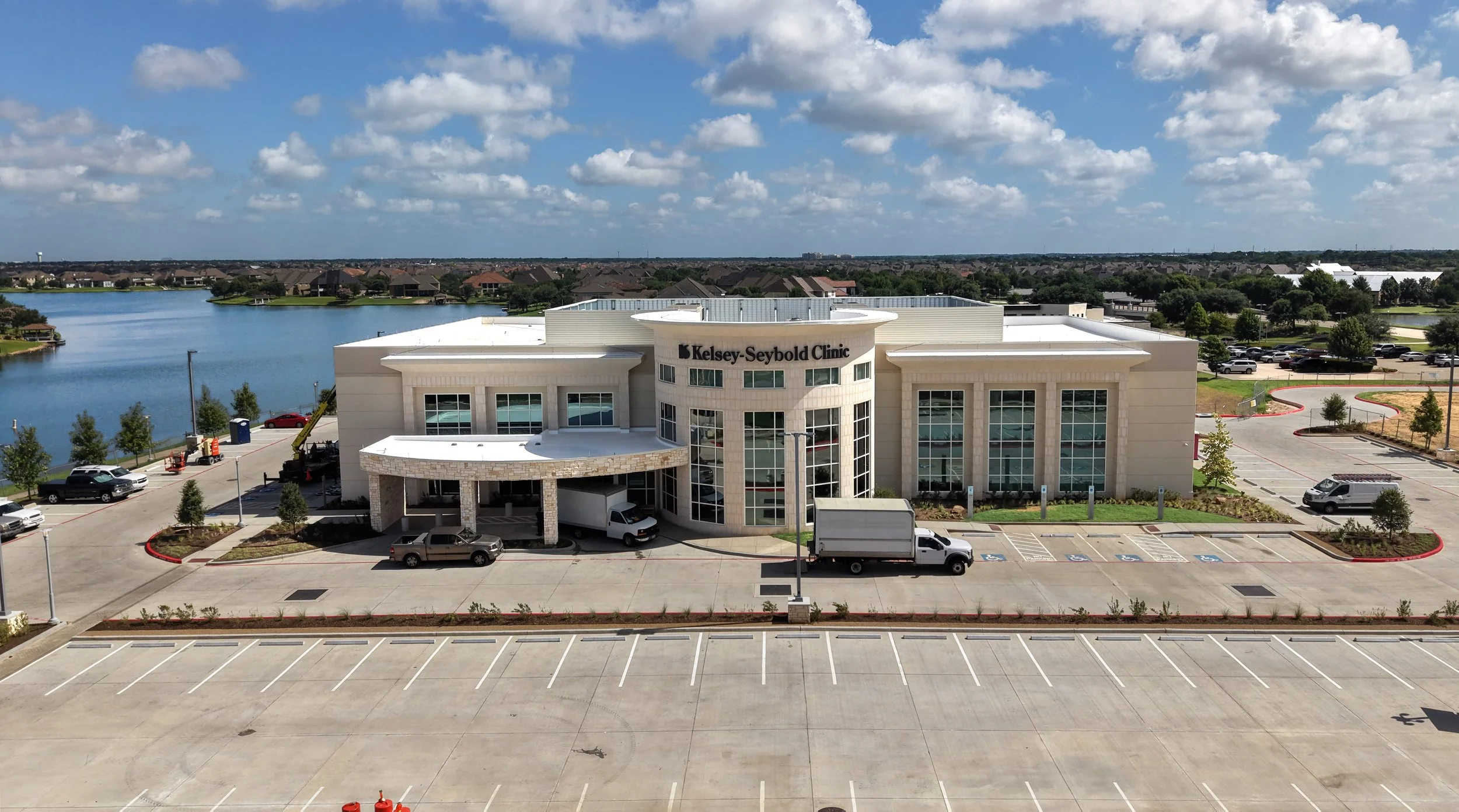
Aerial View
Perspective, detail, data, and depth.
What We Capture
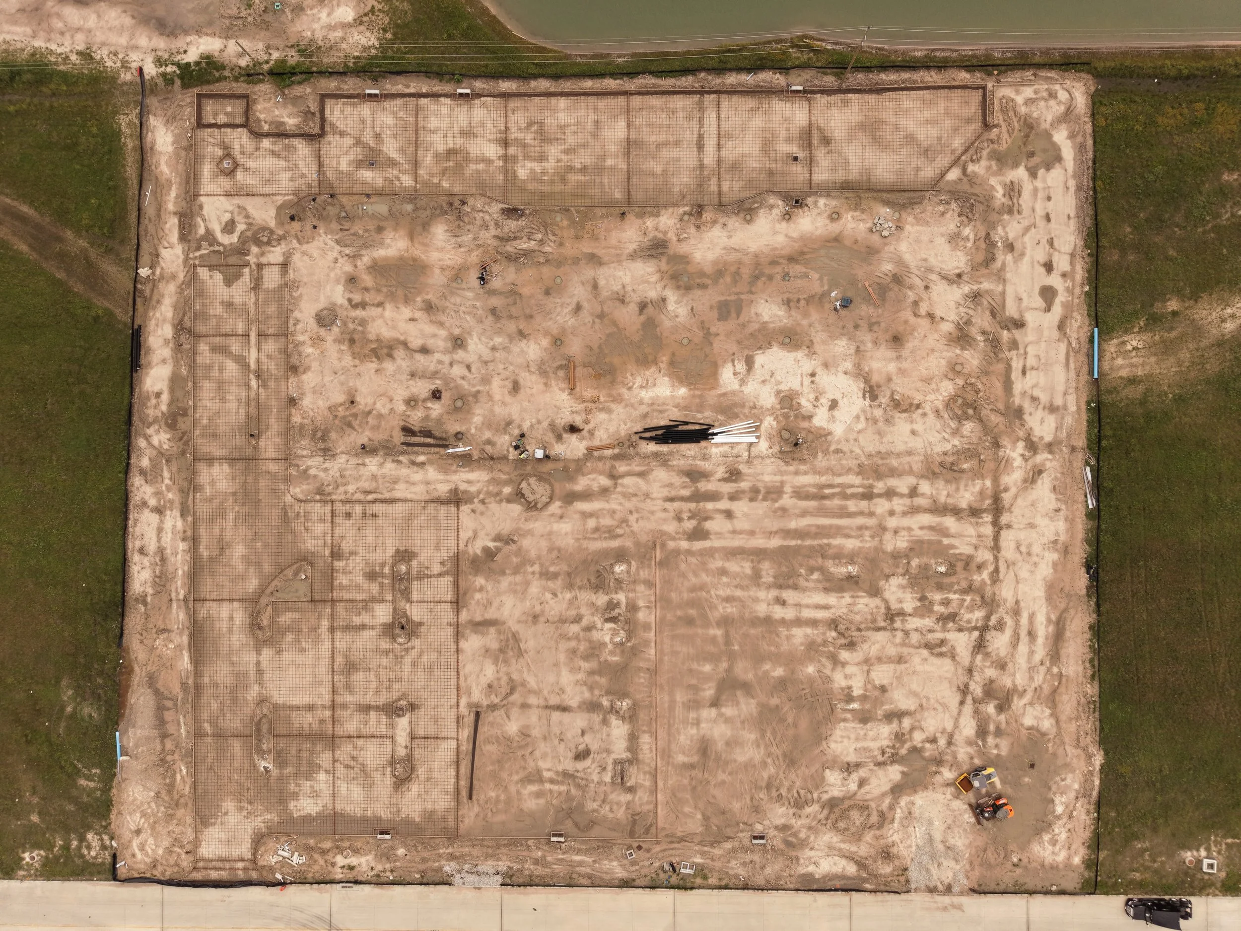
Nadir Shots
Straight-down aerial views that document the full footprint of a site, ideal for tracking grading, foundations, and layout accuracy.
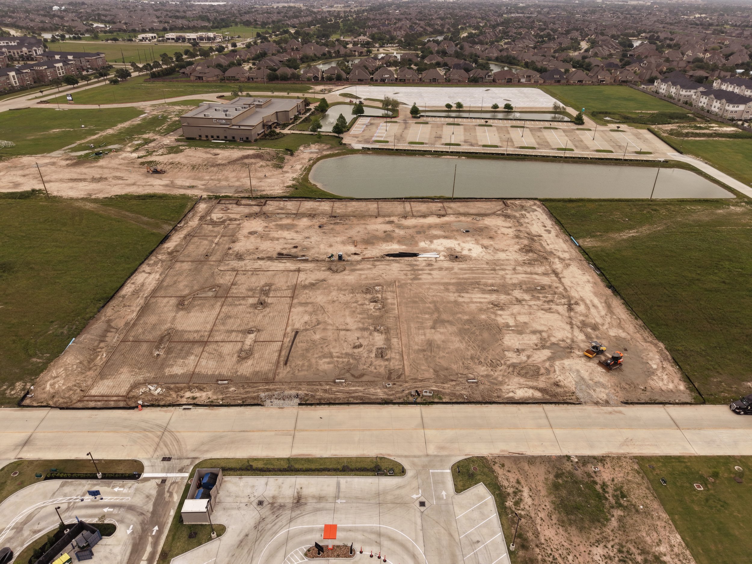
Oblique Shots
Wide-angle aerial views captured at an angle, showing the site in context with surrounding roads, structures, and access points.
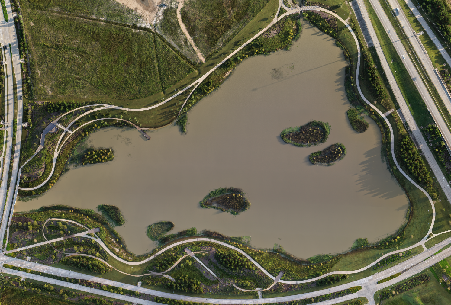
Orthomosaic Mapping
Multiple aerial images stitched into a single detailed map of a site or property, useful for tracking progress or documenting the finished result. Since satellite map imagery can take a long time to update, this gives you a current, accurate view when it matters. Built for progress tracking, not certified survey work. See what a small drone can and cannot map in our DJI Mini 5 Pro mapping breakdown.
A Point-In-Time Record
Every flight is timestamped and geotagged. Each delivery is a dated, located record you can reference months later if a question comes up about what the site looked like on a given day.
Consistent Flight Paths
Recurring site visits are flown along the same waypoint path each time. Waypoint missions start with Tier II. That consistency means side-by-side comparisons actually mean something, instead of two photos taken from slightly different spots and angles. You can follow this approach in action on our Memorial Hermann Cypress build tracking, flown from the same path over several months, with more footage added as it comes in.
Have a project in mind? Connect with us
Progress You Can See From the Sky
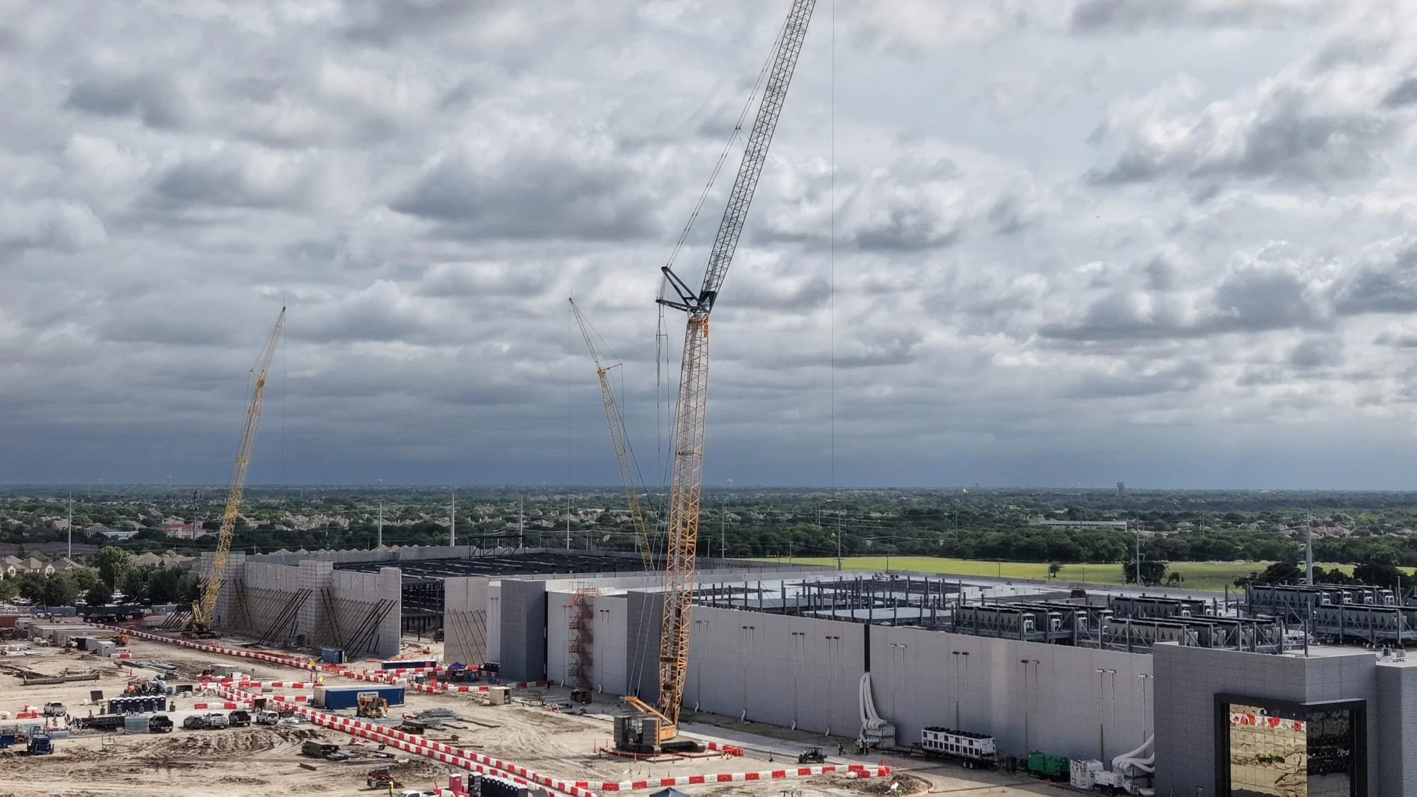
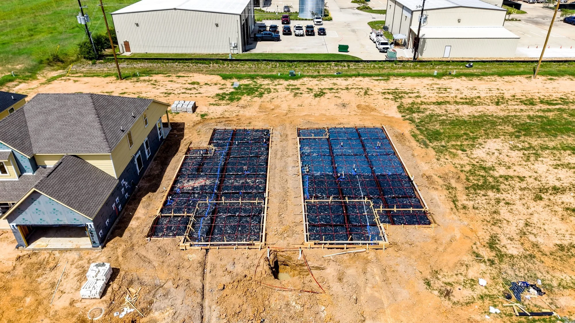
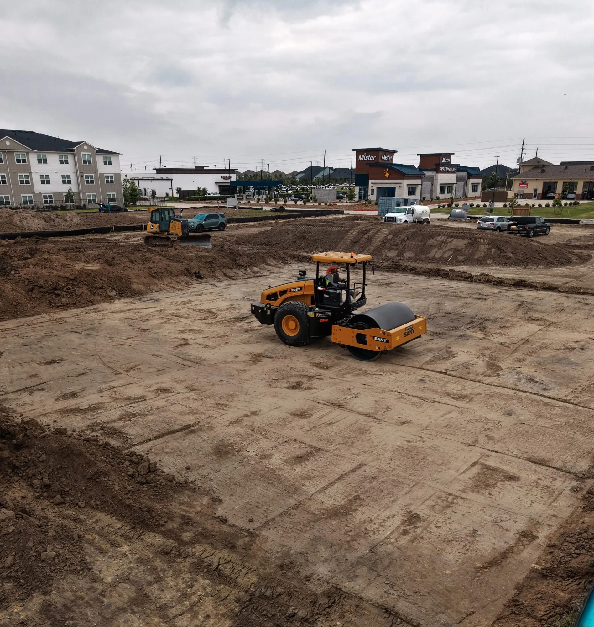
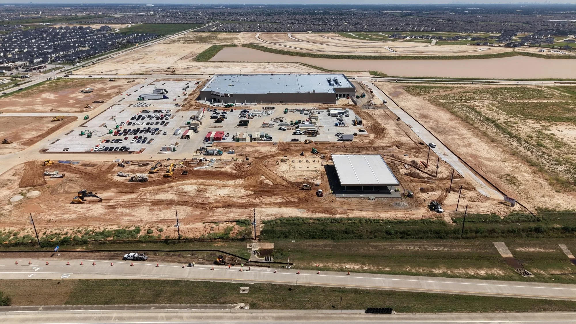
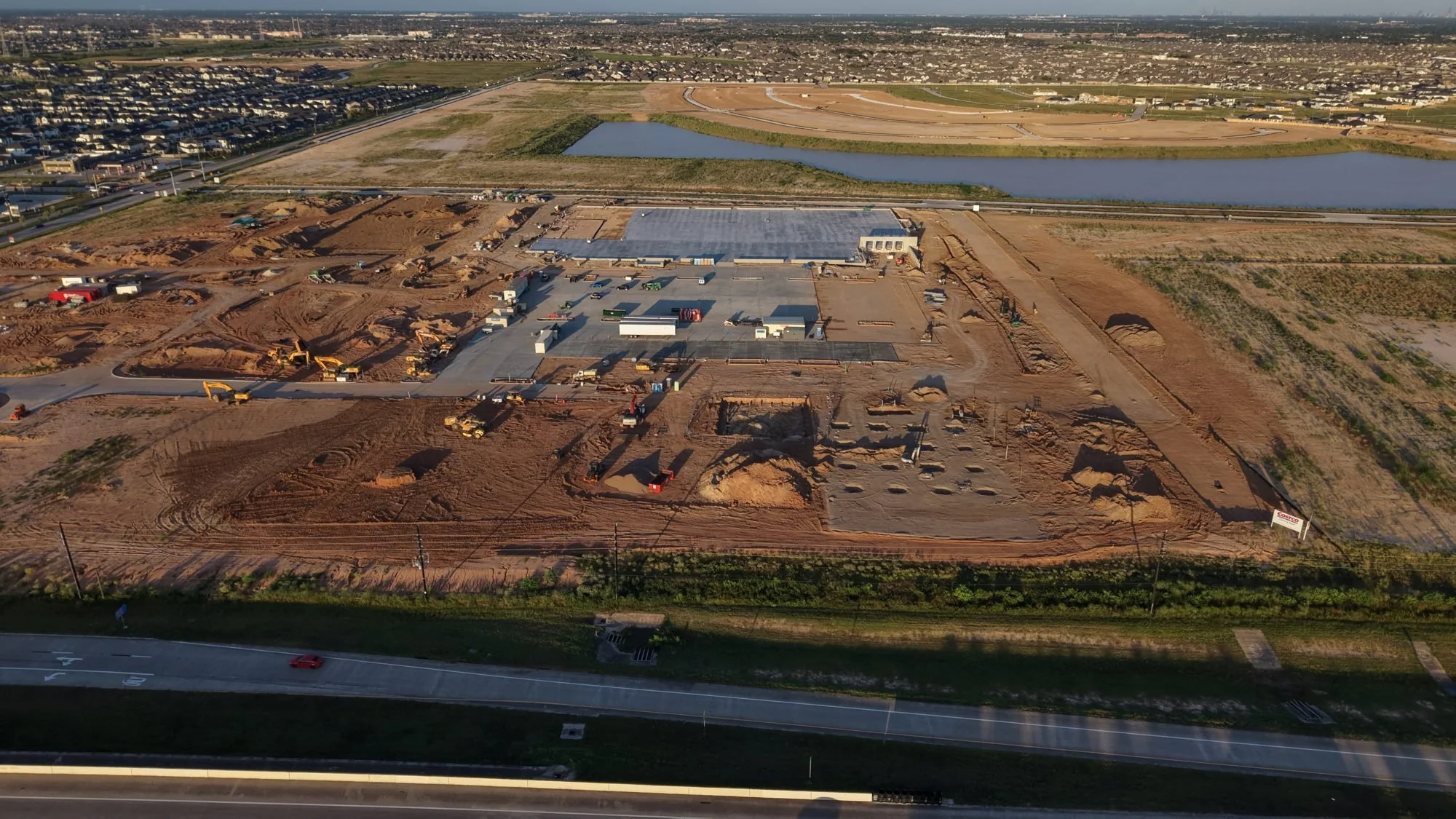
From the air, a few weeks of work is easy to spot. The last two photos below show the same retail site a few weeks apart. In one, crews are setting footings on a bare pad. In the other, the building is up, the parking lot is poured, and the fuel canopy is finished. Flying the same path every visit is what turns photos like these into a clear progress record for owners, lenders, and project teams.
Construction Packages
Every site is different, so your quote depends on acreage, travel distance, and what you need captured. These starting points show what each tier includes. Weekly and biweekly retainers come with a discount, and add ons like same day rush delivery and orthomosaic mapping are available.
Tier I: Standard Capture
From $250
10 to 12 aerial stills in native color
One orbit video around the property
Wide and medium aerial shots plus equipment in operation
A fast snapshot of the site, no waypoint mission
Tier II: Color Graded
From $450
10 to 15 color graded stills
60 seconds of color graded video clips
Waypoint mission: the same flight path every visit for true side by side progress
Adds hero, detail, crew, and safety shots plus reveal and orbit video
Tier III: Full Site
From $950
Everything in Tier II
All clips edited into one continuous video
2 to 3 animated callouts
Horizontal and vertical versions
Construction Drone FAQs
Straight answers on turnaround, scheduling, insurance, and airspace. Still have a question? Book a quick consultation.
★★★★★
“Carlos provided last-minute drone footage of one of our commercial buildings. He promptly delivered the footage, and we were able to showcase the work to a customer right on time.”
Diana Moreno
Commercial building footage
-
Photos are delivered within 24 hours of the flight. Video takes 48 to 72 hours, depending on the type of edit.
-
Through a shared Google Drive link. Access stays open for 30 days, and if you need more time, just ask and we will extend it.
-
Yes. We are FAA Part 107 certified and insured, and we can send a certificate of insurance for your job site before the first flight.
-
Yes. Some job sites around Cypress, Katy, and Houston sit in controlled airspace near local airports. We request FAA airspace approval ahead of time so your schedule stays on track.
-
Choose weekly, biweekly, or monthly visits. Every flight follows the same waypoint path, so each visit lines up for side by side comparison. Weekly and biweekly schedules come with a discounted rate.
-
Two days of notice is ideal. We also handle next day and same day flights when the schedule allows. Emergency same day flights include an added fee.
-
Rescheduling for weather is always free. A 25% deposit locks in your date, which gives us room to plan a safe flight and work around any conditions that come up.
-
Yes. We cover the Greater Houston area, with a mileage fee based on the distance from our dispatch location.
-
No. Our mapping is built for visual progress tracking, not certified survey work. If you need survey grade results, we can capture the data and hand it to your licensed surveyor or engineer.