
What the DJI Mini 5 Pro Can (and Cannot) Map
Most people assume drone mapping requires expensive, specialized hardware. The truth is more nuanced. The DJI Mini 5 Pro, a compact, consumer friendly drone, can produce genuinely useful mapping data for tracking a property or job site over time. It just has real limits worth understanding before relying on it for anything precise.
How It Actually Works
Mapping isn't just flying over a site and taking a photo. Each flight captures hundreds of overlapping images, processed through photogrammetry software to build a dense point cloud, essentially a 3D model made of millions of individually measured points. From there, that data generates a Digital Surface Model, a detailed representation of elevation across the site, and finally an orthomosaic, a single flat map stitched together from all those images with distortion corrected out.
What It Can Do
For visual progress tracking, this process is more than enough. You can see how a property has changed from one flight to the next, spot layout and grading changes, and document a site's condition on a given day with a level of clarity a handful of ground photos can't match.
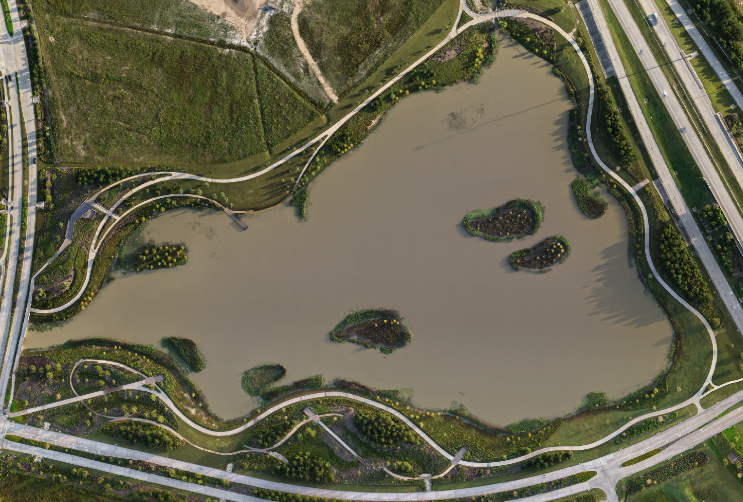
Orthomosaic Sample
A stitched aerial map of the Bridgeland Prairie Land Iconic Butterfly Structure park in Cypress, TX, generated from DJI Mini 5 Pro flight data. Useful for documenting a finished site or tracking one still under construction.
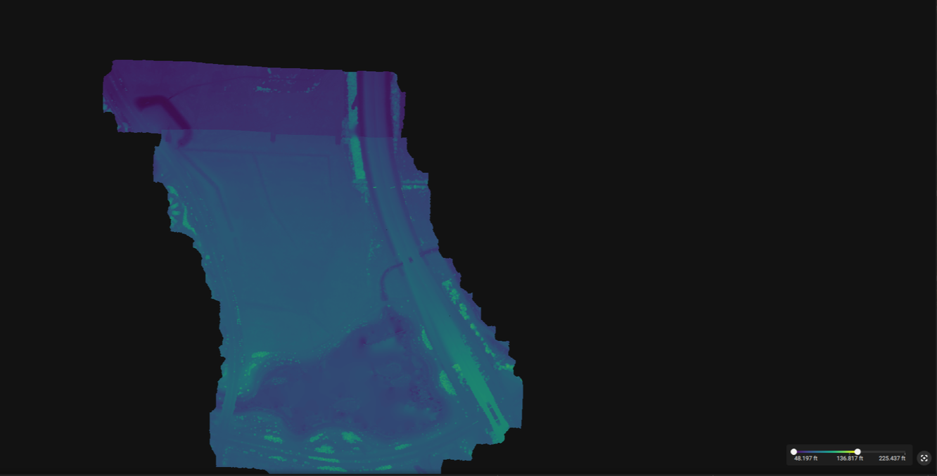
Data Behind The Map
The same Bridgeland Prairie Land flight data processed into a dense point cloud in PIX4Dmatic, the intermediate step between raw drone images and the finished orthomosaic shown above.
This same park sits along Bridgeland Creek Parkway, near Grand Parkway. Since satellite map imagery for newer developments can take months or years to update, having a current, accurate aerial on file is genuinely useful, whether for documentation, marketing, or simply having an up-to-date record on hand.
What It Can't Do
This drone doesn't have RTK (Real Time Kinematic) positioning, the hardware that gives professional survey grade drones their centimeter level accuracy. Without RTK, the resulting point clouds, elevation models, and orthomosaics are not survey accurate. They shouldn't be used for legal boundary determination, elevation certificates, or any application where exact measurements carry contractual or regulatory weight.
Where That Leaves It
For general contractors, property owners, and site managers who want a clear, dated visual record, not a certified survey, this is a genuinely capable tool. It's the difference between "here's what the site looked like on June 3rd" and "here's a legally binding measurement," and for the vast majority of construction progress tracking, the first one is exactly what's needed.
If a project requires certified survey accuracy, that's a different conversation, and one worth having before a flight is scheduled. But for the ongoing, practical work of watching a site change over time, this setup gets the job done.