
CONSTRUCTION DRONE SERVICES
Aerial documentation for job sites across Cypress, Katy & Greater Houston Area
Progress,
You Can Prove.
Consistent aerial documentation that helps your teams track progress, prevent costly mistakes, and communicate confidently with stakeholders.
Progress Tracking
✳︎
Monthly Retainers
✳︎
FPV Milestone Video
✳︎
Site Documentation
✳︎
Stakeholder Reporting
✳︎
Progress Tracking ✳︎ Monthly Retainers ✳︎ FPV Milestone Video ✳︎ Site Documentation ✳︎ Stakeholder Reporting ✳︎
Why Aerial Documentation Matters
Ground-level photos only show what’s directly in front of the camera. A drone gives your team a consistent, repeatable vantage point that a phone or ladder can’t match. The same angle, the same coverage, every time a flight happens.
That consistency is what makes aerial documentation useful beyond a single nice photo. When every flight follows the same path, you can compare one week to the next and see real progress, not just a snapshot.
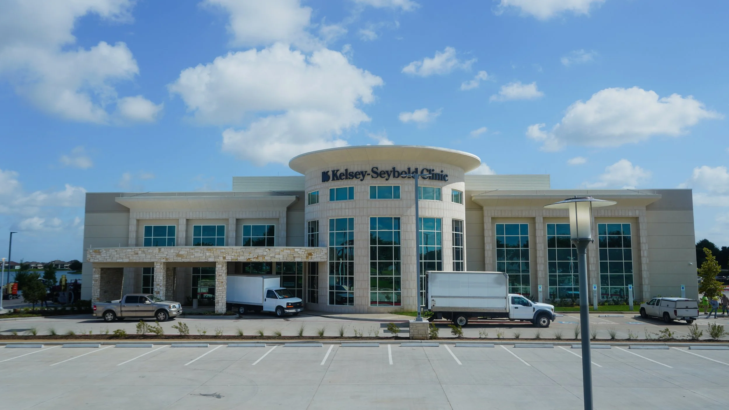
Ground View
A great visual of what’s directly in front of you.
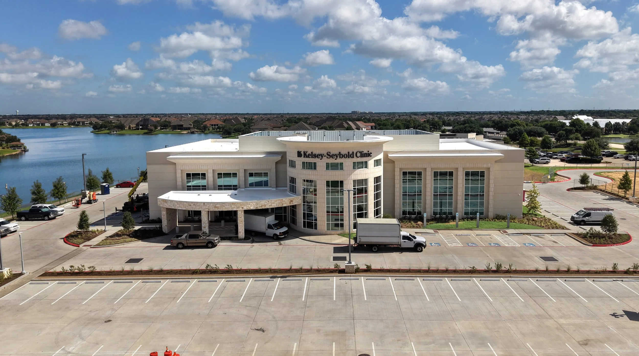
Aerial View
Perspective, detail, data, and depth.
What We Capture
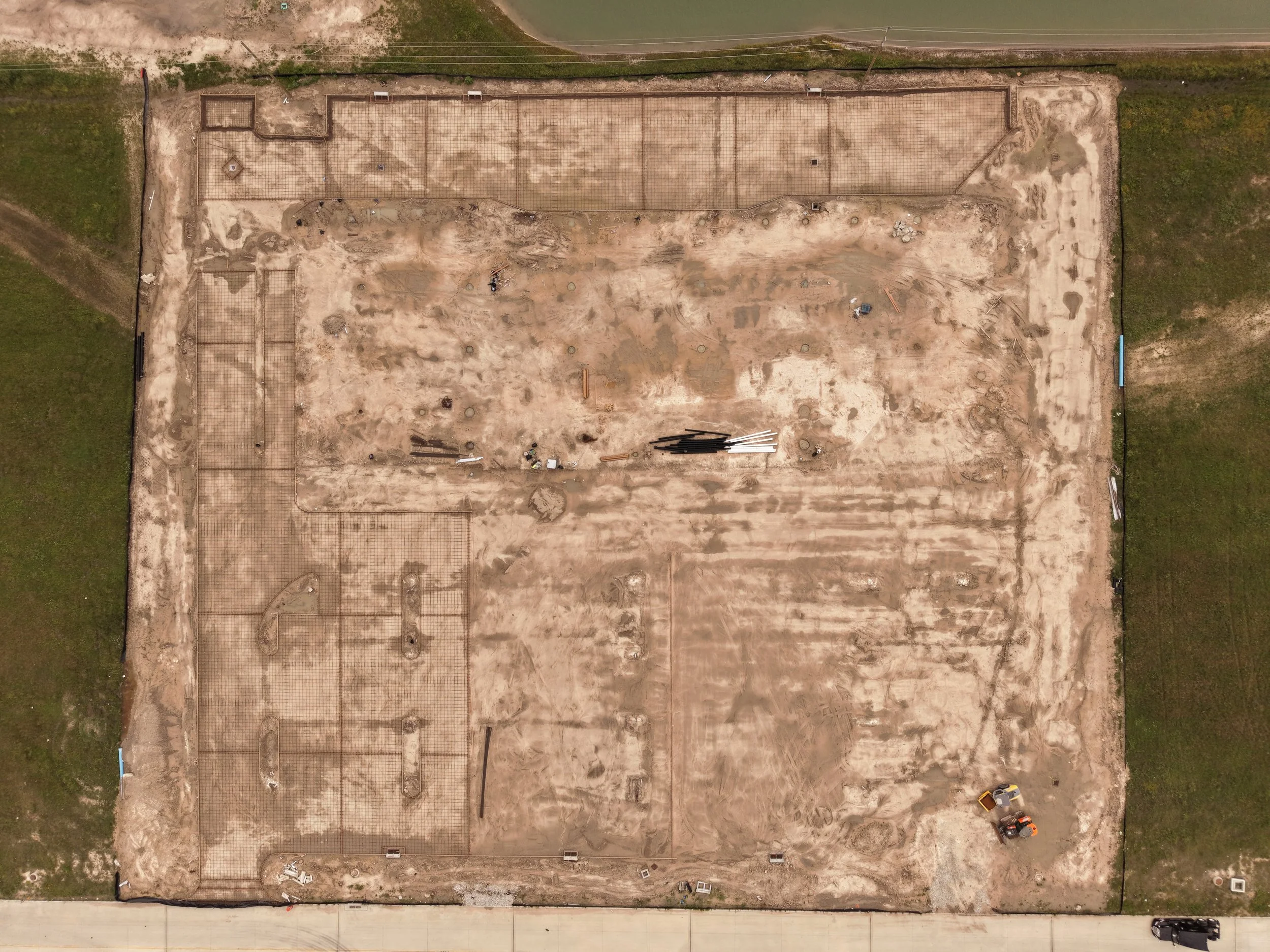
Nadir Shots
Straight-down aerial views that document the full footprint of a site, ideal for tracking grading, foundations, and layout accuracy.
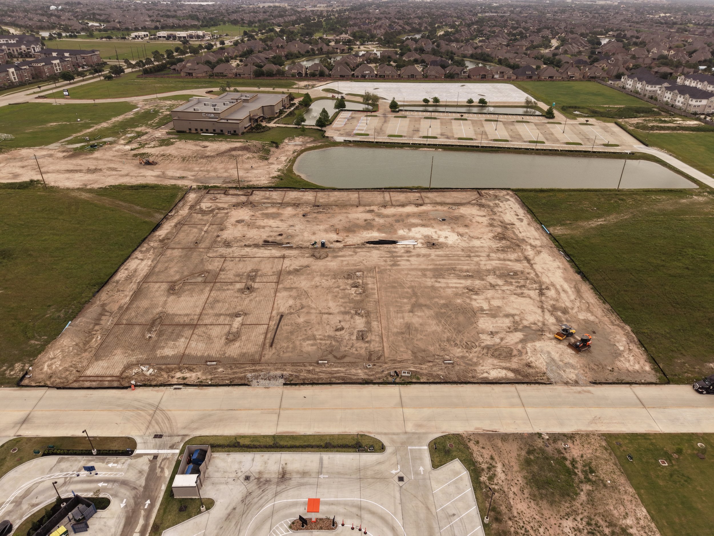
Oblique Shots
Wide-angle aerial views captured at an angle, showing the site in context with surrounding roads, structures, and access points.
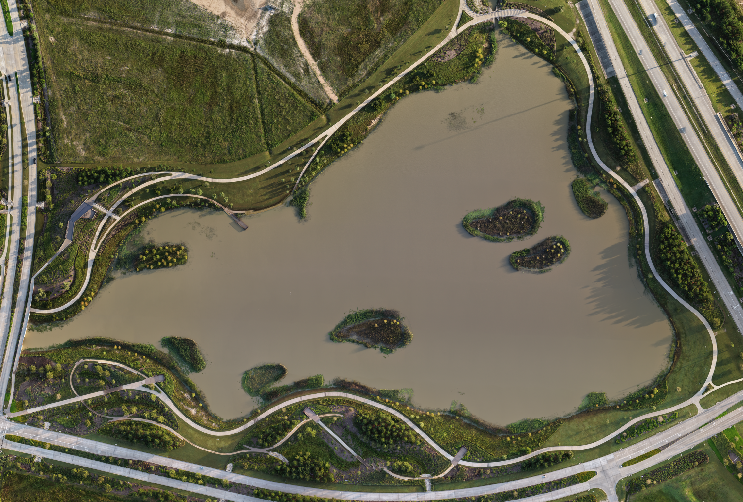
Orthomosaic Mapping
Multiple aerial images stitched into a single detailed map of a site or property, useful for tracking progress or documenting the finished result. Since satellite map imagery can take a long time to update, this gives you a current, accurate view when it matters. Built for progress tracking, not certified survey work.
A Point-In-Time Record
Every flight is timestamped and geotagged. Each delivery isn't just a photo, it's a dated, located record you can reference months later if a question comes up about what the site looked like on a given day.
Consistent Flight Paths
Recurring site visits are flown along the same waypoint path each time. That consistency means side-by-side comparisons actually mean something, instead of two photos taken from slightly different spots and angles. We're currently building out a live example of this, tracking a single site along the same flight path over several months, and will add that footage here as it comes in.