
Drones are not new technology. They have been around for a long time. What is new is how far the technology has come. The cameras, the flight systems, the RTK positioning, the mapping software. All of it has reached a point where a drone is no longer a toy or a nice camera in the sky. On a jobsite, it is a professional tool that produces real data you can make decisions with.
That last part matters most to me. I run First to Fly Drone Services LLC here in Cypress, Texas, and my background is in finance and business intelligence, so I look at a drone as a tool to collect the data. The value lies in what that data lets you do and how you present it. For the general contractors, developers, and project managers building across the Houston area, that value shows up in three places: safety, speed, and documentation.
Safety Comes First
On the construction side, safety is always the concern. There are parts of a building you need eyes on that are hard to reach. In a lot of cases, getting a person up there to inspect a roofline or high steel means scaffolding, a lift, or other heavy equipment. That is time, cost, and risk.
A drone gets to those areas in minutes, and nobody has to climb anything! You get the image or the video of the exact section you need, and your team stays on the ground. When the goal is to reduce the number of times a person is put in a high-risk position, this is easily a safety win.
Speed of Site Changes How Fast You Can Act
Sites move fast, and time is money. The speed at which you get usable data with a drone is unmatched on foot. Some angles are just impossible on foot.
With RTK equipped drones, we can survey a site far faster than a full team walking it, and the data is highly accurate. That means a mapping and progress capture that used to take a crew a full day can happen in a fraction of the time.
The other side of speed is turnaround. Because most of this data does not need heavy editing to be useful, we can hand a team a clean visual report relatively fast. You are not waiting a week to see where things stand. You are looking at it now, while you can still act on it.
Our Goal is to provide useful data for decision making, timing matters.
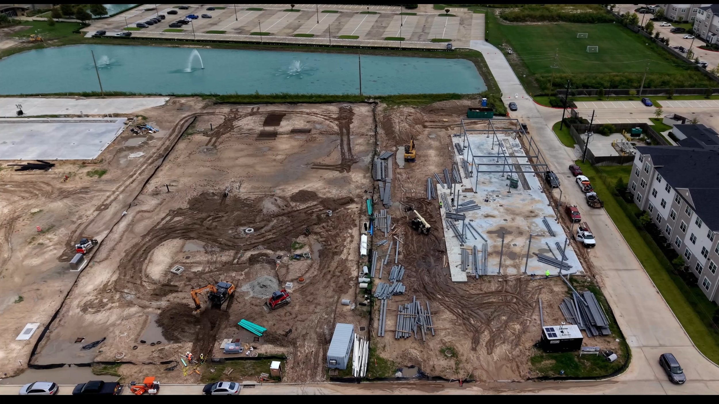
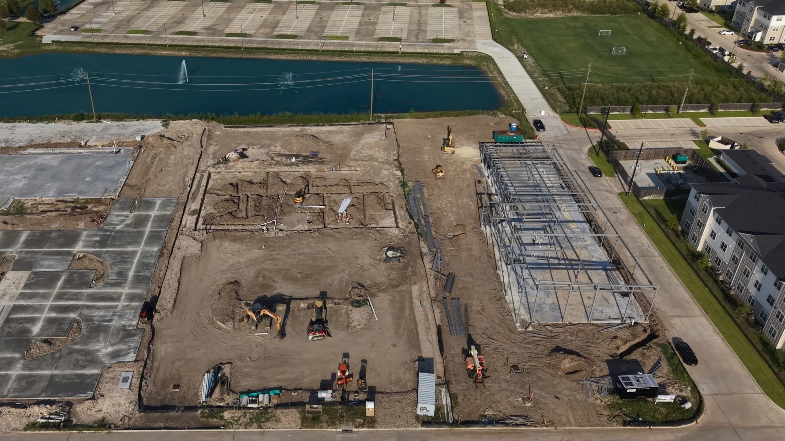
Documentation Is Where It All Pays Off
This area splits into a few different uses, because the same visual intelligence can be utilized differently by various stakeholders. Again, it’s all about what you do with this visual data.
Progress for investors and stakeholders
A monthly, biweekly, or weekly aerial capture shows exactly how fast a project is moving and whether it is on schedule or falling behind. For an investor or a lender, this is a simple, honest visual. This is what it looks like. This is where your money is going. No interpretation needed, they can see the puzzle being assembled in real time.
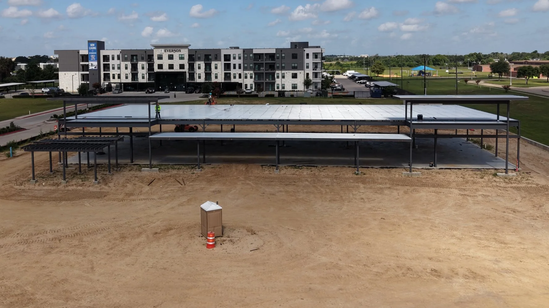
One flight like this shows an investor exactly where the project stands, no site visit required.
Site records for safety, insurance, and planning
That same view from above becomes a planning tool. You can see how the build sits on the lot, track material staging and access routes, and use each capture to plan the next phase of work. It also lets you catch hazards early and spot issues in the build before they turn into a problem later. And if you ever need it for insurance, you have a documented record of exactly what the site looked like and when. The metadata behind every image and video captures the date and time it was created, so there is no question about what happened when.
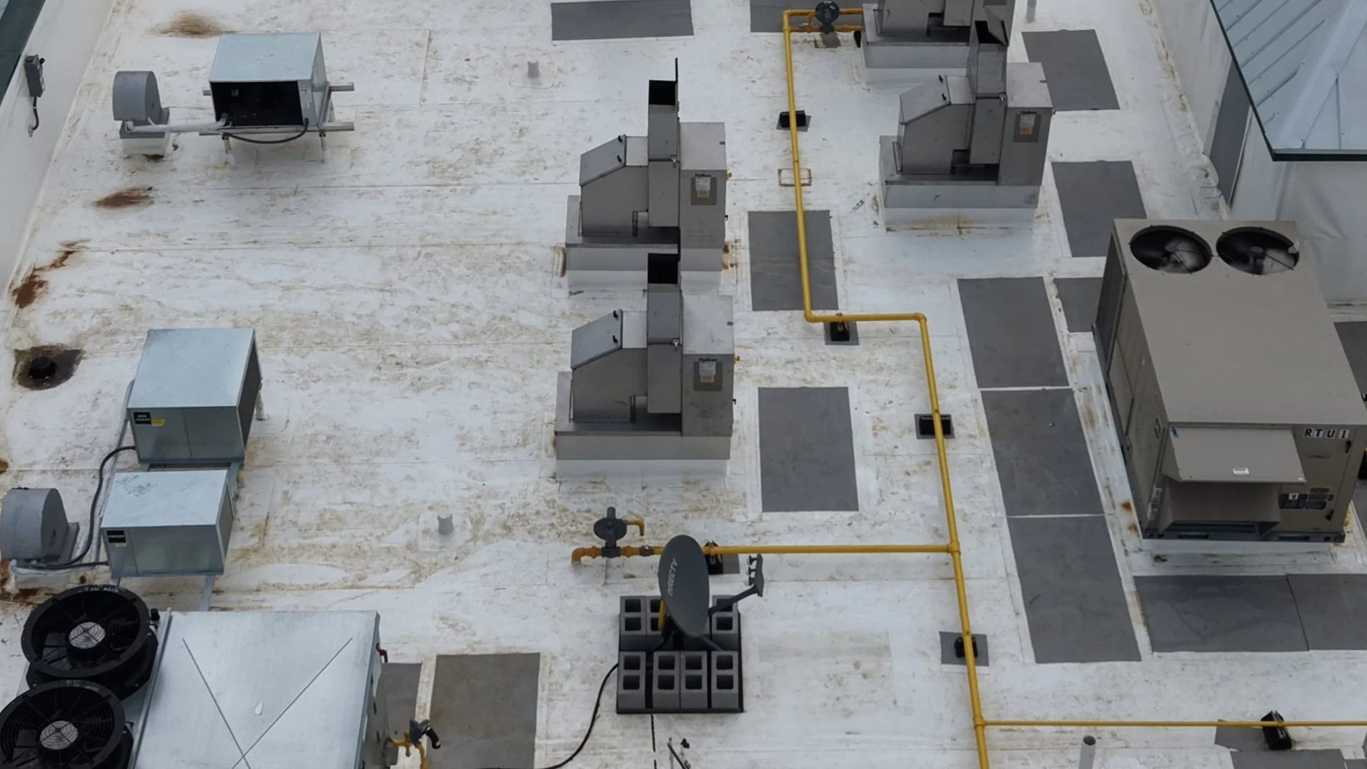
Aerial rooftop inspection of a commercial building in the Houston area showing HVAC units, ductwork, and gas lines documented from above without roof access
Interior and As Built Documentation, the one most people overlook
I fly an FPV drone inside the building, safely, to capture the interior at each phase of the build. Once the walls go up, you lose sight of everything behind them. The pipes, the wiring, the utilities. A flythrough captured at the right phase becomes a permanent record of exactly where all of that lives.
I saw the pain of not having this firsthand. I spent years working in a hospital environment, and when we had a leak, we would be up in the ceiling trying to track down the utilities and figure out where everything ran. If we had a clean visual record of what was behind those walls, that problem takes minutes. For a hospital, a plant, or any building you have to maintain for decades, that record is worth a lot.
This is where it becomes invaluable. Having the facility design on paper is one thing, but pairing it with a real visual record of what was actually built is what makes it powerful. You are looking at exactly how it went in.
How We Keep the Data Honest
Here is what makes the progress data actually trustworthy. At First to Fly Drone Services, we generate waypoint missions for every construction site. That means the drone flies the same programmed path every visit. A capture from three months ago and a capture from today are shot from the identical positions. So when you compare them, you are seeing real change, not two different angles. That is how we build consistency and accuracy into the record.
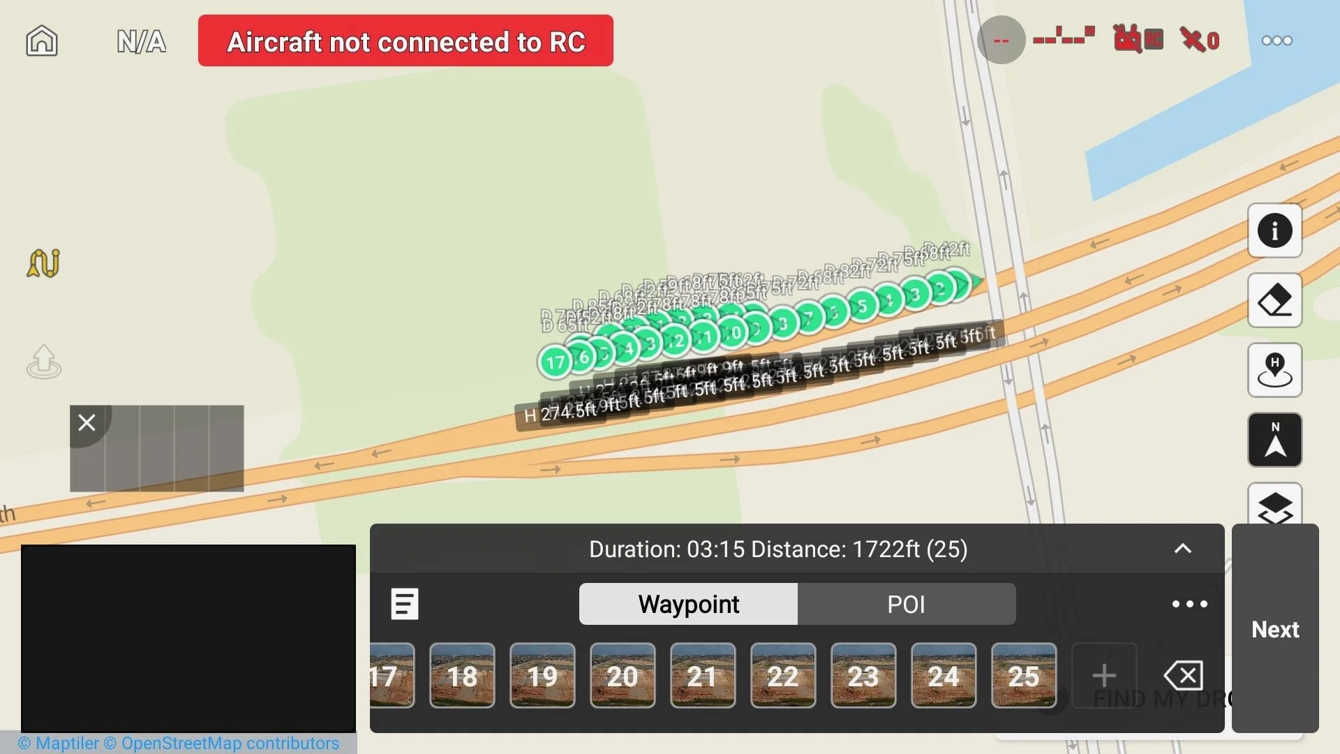
This is how we keep the comparisons honest.
Every site gets a programmed waypoint mission, so the drone flies the identical path and altitude on every visit.
Who Benefits, and How
General contractors get a faster, safer way to inspect and a dated record that protects them.
Workers stay on the ground and out of high risk positions.
Project managers get progress they can actually measure against the schedule, and early warning on hazards and delays.
Investors and lenders get a clear, honest visual of where the project stands and where their money is going.
Marketing teams get the part that keeps paying off after the build is done. All of this footage is a head start on launch content. Once the project finishes, the relationship does not end. That is where we hand off to marketing and create something for them, including a finished interior flythrough of the property that becomes the centerpiece of how they sell it.
That is the whole point. The drone is the tool. The data is the value. On a construction site, that data works for everyone from the crew on the ground to the team selling the finished building.
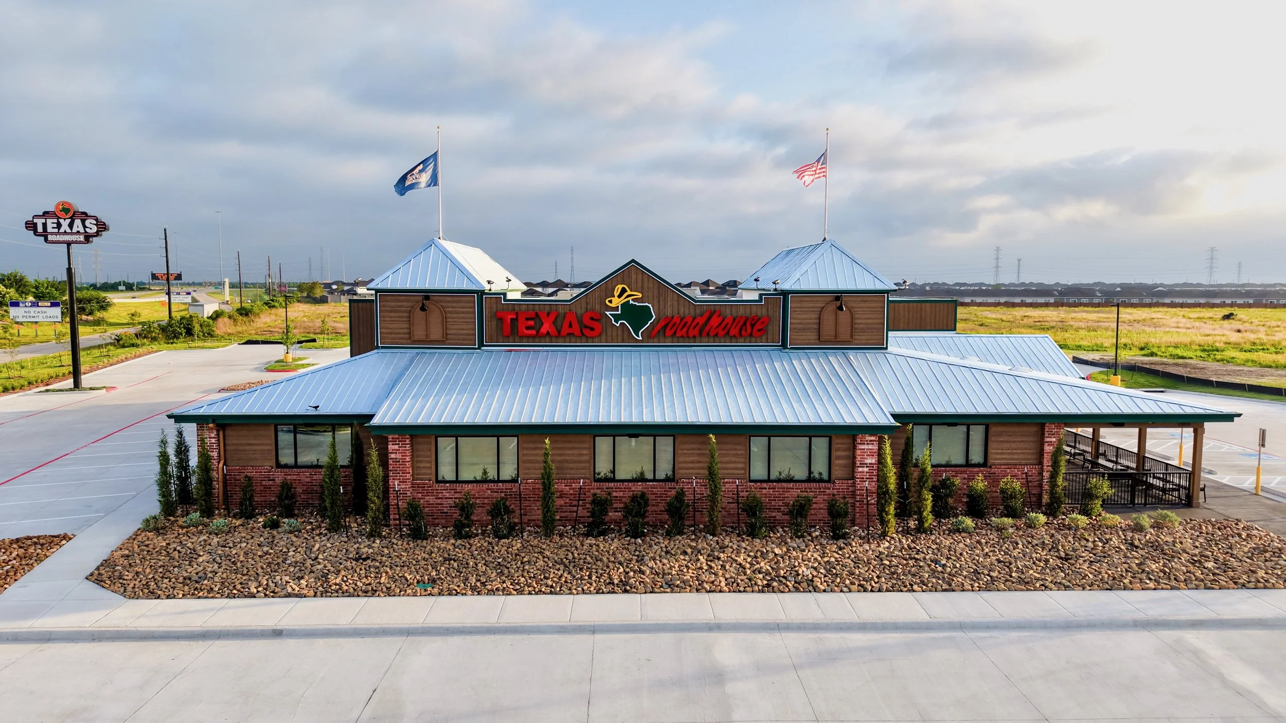
Completed commercial project in Cypress, TX.
Let's Get Your Site on the Flight Schedule
If you have a project going up around Houston and you want a clear, honest record of how it is progressing, let's talk. I'll show you exactly what the data can do for your team, your investors, and your marketing down the line.
First to Fly Drone Services LLC is a veteran owned drone services company based in Cypress, Texas. We are VetHUB certified and a verified Texas Veteran Owned Business through the Texas Veterans Commission, and FAA Part 107 certified. We provide construction documentation, aerial progress tracking, and commercial marketing across the Houston area.