
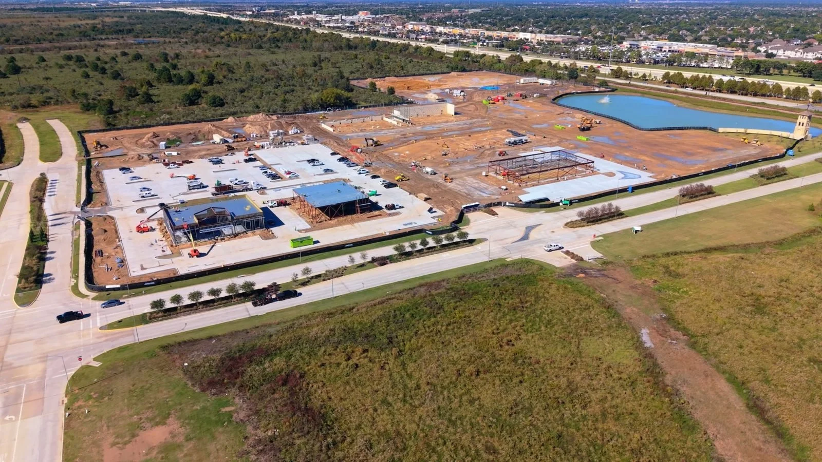
On November 16 I flew over Dunham Pointe, the new retail village going up at Highway 290 and Mason Road in Cypress. This is the baseline. Any time I go back, I fly the same path so you can watch the site change from one visit to the next, the same way I document projects for paying clients.
What is being built
Dunham Pointe is a 202,000 square foot retail and restaurant district on 25 acres, developed by Trademark Property Company and MetLife Investment Management. Whole Foods Market will anchor the center, the first Whole Foods in Cypress. Fourteen tenants have signed so far, including Nordstrom Rack, Shake Shack, Fidelity, LaserAway, Solidcore and Texas Country Boots. Construction on the main center started in October 2026.
Sources: Chain Store Age, Traded, ConnectCRE and My Neighborhood News.
Why I fly the same path every time
A pretty aerial is nice to look at. A dated record is something you can use. I fly the same waypoint path at the same height and angles on every visit, and every file is dated and GPS tagged. That way each flight lines up with the last one, and you can see exactly what changed in between: new slabs, framing, parking lots, landscaping.
When I go back, I add the new photos to this post so you can line them up against this first flight.
Who this is useful for
Builders and owners use a record like this to show investors progress without a site visit. Brokers leasing space use it to show future tenants how the center sits next to 290 and the homes around it. Agents selling nearby homes use it to show buyers what is coming down the street.
Building, leasing or selling near Dunham Pointe? Book a Flight and I will set up dated aerial records for your project.